University of Michigan Introduces Innovative Interactive Campus Map
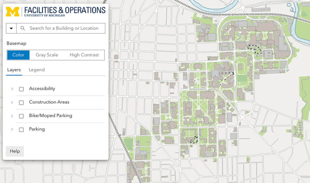
In a significant step towards enhancing campus accessibility, the University of Michigan has rolled out a new Facilities and Parking Map. This interactive online resource aims to streamline access to crucial operational details, catering to both the university community and visitors alike.
The map is designed to offer flexibility, allowing users to select from various operational information layers, which can be viewed either individually or in combination. These layers cover essential aspects such as exterior accessibility features, major construction zones, and designated parking areas for both vehicles and bikes or mopeds.
Developed by Facilities & Operations through geographic information systems (GIS) technology, the map signifies a modernization of how operational data is communicated and sustained across the campus.

This platform consolidates information that was previously scattered across several static PDF maps, offering a singular, user-friendly resource that can be easily customized and updated as needed.
“Making this map publicly available gives students, employees, visitors and community members a more accessible and reliable way to find important operational information across campus,” stated Lukeland Gentles, assistant vice president for operational support. “By bringing these resources together into a single, easy-to-update platform, we’re improving how people navigate campus and helping them plan ahead with more current information.”
The creation of the map was driven by a demand from Facilities & Operations staff for a more streamlined method to manage and share operational data campus-wide. Recognizing its potential benefits, F&O teams and leadership decided to make the tool available to a wider audience, including students, faculty, staff, and community visitors.
Brian McElroy, GIS manager in Facilities & Operations, noted, “This map brings several facilities services into one easy-to-use place. Users can search locations, turn layers on or off, and quickly find the information that matters most to them. We hope people will try it out and use it to better plan their time on campus.”
As the university’s needs evolve, additional layers and features may be integrated into the map to ensure it remains a relevant and comprehensive tool for all users.
This new Facilities and Parking Map underscores Facilities & Operations’ ongoing commitment to enhancing the accessibility, responsiveness, and utility of campus information for everyone involved.